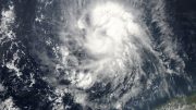
Known as ‘Rolly’ in the Philippines, the storm likely caused catastrophic damage in the region of Catanduanes Island, where the typhoon made its initial landfall with 195 mph winds.
Super Typhoon Goni made landfall near Bato, Catanduanes Island, Philippines, at 4:50 a.m. local time on November 1 (4:50 p.m. EDT October 31), with sustained winds of 195 mph and a central pressure of 884 mb, according to the Joint Typhoon Warning Center (JTWC). Goni was the strongest landfalling tropical cyclone in world recorded history, using one-minute average wind speeds from the National Hurricane Center for the Atlantic/northeast Pacific and one-minute average winds from JTWC for the rest of the planet’s ocean basins.
The previous record was jointly held by Super Typhoon Meranti, which made landfall on September 16, 2016, on Itbayat Island, Philippines, and Super Typhoon Haiyan, which made landfall on November 8, 2013, on Leyte Island, Philippines. Both had maximum winds of 195 mph at their peak intensity, but were weaker at landfall, with 190 mph winds, according to JWTC. There are no official world records for strongest landfalling storms, since the JTWC does not routinely assign landfall intensities in their post-season summaries (though they did make an exception for Super Typhoon Haiyan).
The Japan Meteorological Agency (JMA), recognized by the World Meteorological Organization (WMO) as the official agency for issuing typhoon forecasts in the northwestern Pacific, gave Goni a weaker rating at landfall: 140-mph sustained 10-minute average winds, with a central pressure of 905 mb. To convert from 10-minute average winds to the one-minute average winds used in the U.S., one needs to multiply by a factor of about 1.1, depending on the location of the wind sensor. So JMA’s estimate for Goni comes out to about 155 mph one-minute average winds, a far cry from JTWC’s 195-mph estimate.
It is concerning that two expert groups would come up with such widely divergent wind estimates for Goni’s peak intensity. Satellite estimates using synthetic aperture radar (SAR) of Goni’s winds at 21:17 UTC October 30 were as high as 180 mph, averaged over a 3 km pixel in the eyewall. JTWC assigned Goni 180-185 mph winds at that time, giving credence to its intensity ratings for Goni. The true intensity of Goni will likely never be known, as there are no direct measurements; the Air Force Hurricane Hunters stopped flying into Pacific typhoons in 1974.
The top 11 strongest tropical cyclones at landfall in world history, according to data from the National Hurricane Center (NHC) and JTWC are:
1) 195 mph: Super Typhoon Goni, 2020, Catanduanes, Philippines;
2) 190 mph: Super Typhoon Haiyan, 2013, Leyte, Philippines;
2) 190 mph: Super Typhoon Meranti, 2016, Itbayat, Philippines;
4) 185 mph: Hurricane Dorian, 2019, Bahama Islands;
4) 185 mph: Great Labor Day Hurricane, 1935, Florida, U.S.;
4) 185 mph: Super Typhoon Joan, 1959, Eastern Taiwan;
7) 180 mph: Hurricane Irma, 2017, Leeward Islands;
7) 180 mph: Cyclone Winston, 2016, Fiji;
7) 180 mph: Super Typhoon Megi, 2010, Luzon, Philippines;
7) 180 mph: Super Typhoon Zeb, 1998, Luzon, Philippines; and
7) 180 mph: Cyclone Monica, 2006, Northern Territory, Australia.
Ominously, seven of the 10 strongest landfalls in recorded history have occurred since 2006. Prior to Goni, 20 category 5 super typhoons with winds of at least 160 mph had hit the Philippines since 1952, according to NOAA’s historical hurricane tracks (IBTrACS) database.
Goni officially the fifth strongest tropical cyclone in history (by wind)
Goni’s 195 mph sustained winds made it the fifth strongest tropical cyclone in world history (by one-minute average wind speed). Note that a tropical cyclone’s winds are generally stronger when its central pressure is lower. However, that relationship is not exact, because the size of the cyclone is also a factor, and a smaller cyclone will have stronger winds for a given central pressure.
Officially, here are the strongest tropical cyclones in world history, according to JTWC and NHC (using one-minute average sustained winds):
– Hurricane Patricia (2015), 215 mph winds, 872 mb pressure. Made landfall in Mexico with 150 mph winds, killing 8.
– Super Typhoon Nancy (1961), 215 mph winds, 882 mb pressure. Made landfall as a Cat 2 in Japan, killing 191 people.
– Super Typhoon Violet (1961), 205 mph winds, 886 mb pressure. Made landfall in Japan as a tropical storm, killing 2 people.
– Super Typhoon Ida (1958), 200 mph winds, 877 mb pressure. Made landfall as a Cat 1 in Japan, killing 1269 people.
– Super Typhoon Haiyan (2013), 195 mph winds, 895 mb pressure. Made landfall in the Philippines with 190 mph winds, killing over 6,000 people.
– Super Typhoon Meranti (2016), 195 mph winds, 890 mb pressure. Made landfall in the Philippines with 190 mph winds, then in China with 100 mph winds, killing 47 people.
– Super Typhoon Kit (1966), 195 mph winds, 880 mb pressure. Did not make landfall.
– Super Typhoon Sally (1964), 195 mph winds, 895 mb pressure. Made landfall as a Cat 4 in the Philippines, killing over 200 people.
However, it is now recognized (Black 1992) that the maximum sustained winds were over-estimated for typhoons during the 1940s to 1960s. Thus, the only reliably measured tropical cyclone stronger than Goni was Hurricane Patricia in 2015, which had a hurricane hunter aircraft inside it to accurately measure its winds.
The winds of Goni, Haiyan, and Meranti were estimated using only satellite images, therefore providing less confidence in their intensity estimates. Satellite methods of estimating intensity, such as the Dvorak technique, cannot capture the most extreme peak winds and central pressures found in storms such as Patricia and Goni. Had a hurricane hunter aircraft flown into Goni or Haiyan or Meranti, peak intensity winds of 215 mph, as were measured in Patricia, may well have been observed. Alternatively, these typhoons could have been weaker than rated, with winds no more than 175 mph.
Dr. Hugh Willoughby, former head of NOAA’s Hurricane Research Division, had this to say in 2017 about the winds measured in Super Typhoon Nancy and the other high-end typhoons from this list in the 1960s:
I would not take the winds seriously because reconnaissance meteorologists estimated them visually. A decade later when I flew with the VW-1 hurricane hunters, we had the same Doppler system used to measure the winds of Typhoon Nancy. It tracked the aircraft motion relative to the (possibly moving) sea surface. It couldn’t get a coherent signal in high winds because the beam reflected from both the actual surface (whatever that is) and blowing spray. Visual estimates are dubious because the surface (under the eyewall!) is hard to see unless you are flying below cloud base (200-300 m) and also because appreciably above 115 mph, it’s completely white with blowing spray. We used to think that we could estimate stronger winds from the decreasing coverage of slightly greenish patches where the spray was thinner. I now think that we were kidding ourselves. In those days the distinctions among wind gust, sustained one-minute winds, etc., were less well defined than they are now. So, we may never know what the 1960s reconnaissance data really means!
Catastrophic damage in the Philippines
The full scope of the damage wrought by Goni in the Philippines (locally known as “Rolly”) will not be known for days, but the region of Catanduanes Island, where the typhoon made its initial landfall with 195 mph winds, likely suffered catastrophic damage. The wind damage from a 195-mph hurricane would be akin to that from a high-end EF3 tornado with 165 mph winds, when accounting for the fact that hurricane wind ratings are for over-water exposure, and friction from land typically reduces wind speeds by about 15%.
A devastating storm surge of 3 – 6 meters (10 – 20 feet) was predicted for a large swath of the coast (Figure 4), and Goni’s surge undoubtedly caused catastrophic damage. This video from Camarines Sur shows an example of the large storm surge and extreme winds from Goni that affected the Philippines.
Torrential rains from Goni caused devastating river flooding and mudslides in the Philippines. Rains mobilized ash deposits on the Mayon volcano in the province of Albay, creating lahars that buried 300 homes under debris (see tweet); a personal weather station near the Mayon volcano recorded 12.12 inches of rain from Goni. The lahars killed at least three, and left three people missing. Devastating river flooding affected a large swath of the Philippines along Goni’s track; one example can be seen in this video from Camalig Province, Philippines.
Goni largely spares Manila
As a result of its relatively small size, its passage over the rough terrain of Catanduanes Island, and the timely arrival of strong upper-level winds out of the east that created 20 – 30 knots of wind shear, the eyewall of Goni collapsed quickly after landfall, and the typhoon did not bring strong winds to the megacity of Manila (metro area population of 13 million). Goni passed about 45 miles to the south of Manila as a tropical storm with 70 mph winds on Sunday, and the highest winds observed at Ninoy Aquino International Airport were 28 mph, gusting to 40 mph.
Goni emerged into the South China Sea on Sunday morning, and was headed west toward Vietnam, where landfall as a weak tropical storm is expected to occur on November 5. The Philippines will be threatened late this week by yet another tropical cyclone, Atsani, which is expected to pass near northern Luzon Island on November 5 as a category 1 typhoon.
Global warming predicted to cause an 8-fold increase in megastorms like Goni
A 2018 paper by Bhatia et al., “Projected Response of Tropical Cyclone Intensity and Intensification in a Global Climate Model,” used the highest-resolution global climate model that has been developed for studying intense tropical cyclones, HiFLOR. The model predicted a highly concerning increase in ultra-intense category 5 tropical cyclones with winds of at least 190 mph: from an average of about one of these Super Typhoon Goni-like storms occurring once every eight years globally in the climate of the late 20th century, to one of these megastorms per year between 2081 to 2100 – a factor of eight increase.
Even more concerning is that the results of the study were for a middle-of-the road global warming scenario (RCP 4.5), which civilization will have to work very hard to achieve. Under the “business-as-usual” track we are currently on, the model might have predicted an even greater increase in ultra-intense tropical cyclones. The fact that we’ve seen four megastorms as strong as or stronger than Goni over the past eight years is a troubling sign.
November 1, 2020


